At a glance
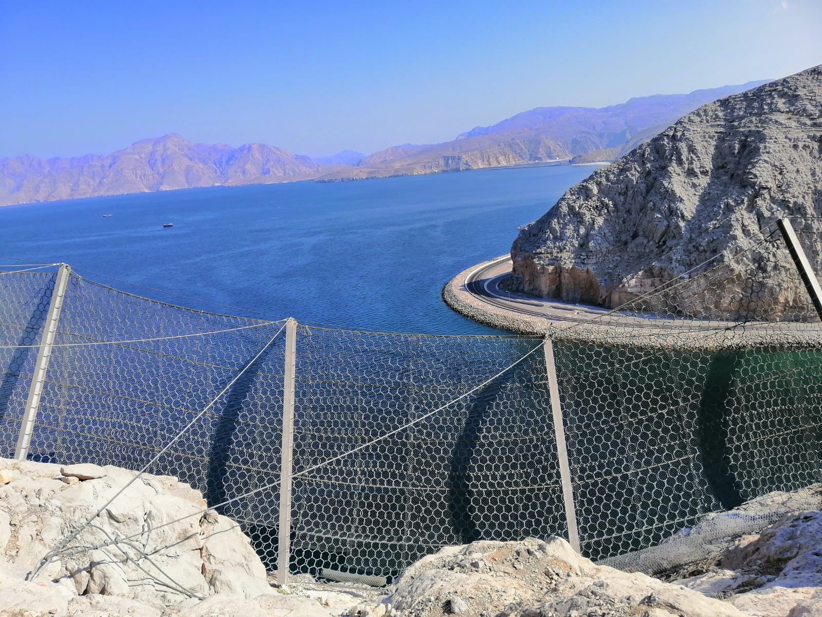
Terrain and geology
The Musandam platform carbonates were folded and lifted at the edge of the Arabian plate and are now tilting slowly into the sea — the drowned valleys, or khors, are the sign of it. Joints are steep and open; the rock breaks along bedding into tabular and blocky pieces. On road cuts the faces are commonly 40 to 80 m high and close to vertical, and the bench between face and carriageway is too narrow to act as a catch ditch.
What fails and why
Two mechanisms account for most of the rockfall we see. Blocks are released from jointed faces after rain and thermal cycling — winter storms and a daily swing of 20 to 30 °C — and undercut ledges fail as slabs. On the coastal road the fall height is the cliff height and there is little bounce on a face this steep: the energy that arrives at road level is mostly translational, which is why trajectory analysis on the surveyed profile, not an assumed one, decides the barrier line and class (see How to choose the energy class of a rockfall barrier).
Systems that fit
- Flexible barriers at the toe of the face or on a bench — 2,000 to 5,000 kJ where design blocks reach 1 to 3 m³, lighter classes where the face sheds small rock (rockfall barriers).
- Drape mesh on high faces that shed small, frequent rock, and anchored high-tensile mesh where a loose zone must be held in place (slope stabilization); the choice is explained in Rockfall protection: flexible barrier or drape mesh?.
- Scaling by rope-access crews before any system goes in (Slope and rock scaling: methods, measurement first, acceptance).
- Concrete buttresses and toe walls where a ledge is undercut — part of the recorded scope on the Khasab–Tibat road.
Access, logistics and corrosion
Most faces have no road at their base and no platform on them: posts, ropes and anchors are flown in by helicopter and fixed by rope-access crews, and the road below usually has to stay open under traffic management. The second constraint is the sea. Salt spray puts every component in the highest marine corrosion category, so wire coatings, rope terminations and fittings are specified for it and inspected yearly and after storms (Rockfall barrier inspection and maintenance: checklist).
What to ask a contractor in Musandam
- A trajectory model on a surveyed profile of the actual face, not a typical section.
- The corrosion class and coating of every component — wire, ropes, posts, anchors, fittings.
- A written helicopter and rope-access plan, and the traffic-management plan for a road that stays open.
- The inspection schedule after handover and who carries it out.
Sources
- Geological maps of the Sultanate of Oman, Ministry of Energy and Minerals (1:250,000 series).
- Artusa site records, Musandam 2018–2019.